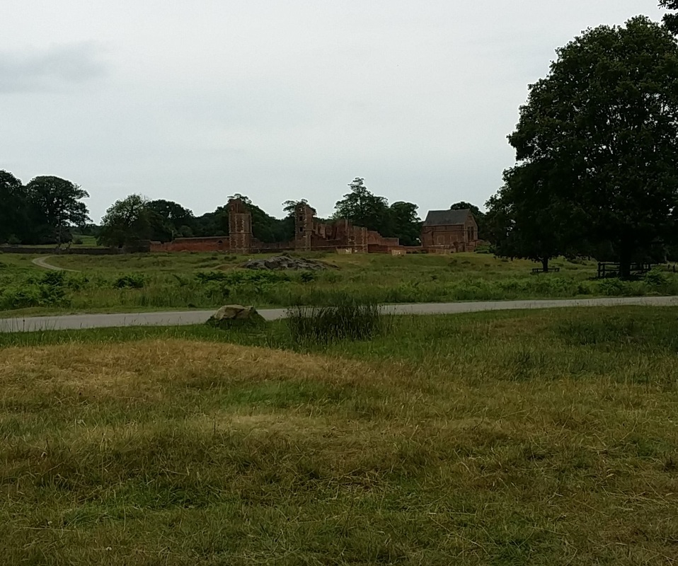
I have spent the last couple of weeks at Bradgate park, looking at mainly C16th century brick, but there was a small amount of possible Roman material – adding nicely to the Roman tile my son found in the park a couple of years ago.
The nearest car park is in Newtown Linford, up the road from the village where I live, but in fact it is a lot quicker to walk to the ruins from my house ‘ across the fields’.
Thanks to the National Library of Scotland we can see that this foot path on the 19th century OS maps:
http://maps.nls.uk/geo/find/#zoom=13&lat=52.6857&lon=-1.1875&layers=6&point=-1.2084,52.6817
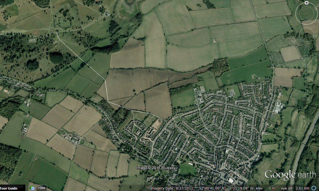
This path is shown here thanks to the magic of google earth:
This path is mentioned in Stephen Lyett’s note (1999 New light on a suspected road between Ratcliffe on Soar and Leicester Trans. Leicestershire Archaeol and Hist. soc, 73 pp 72 – 79) on a possible Roman road/ ancient route. This lines up reasonable well with Anstey lane going towards Leicester and its North gate.
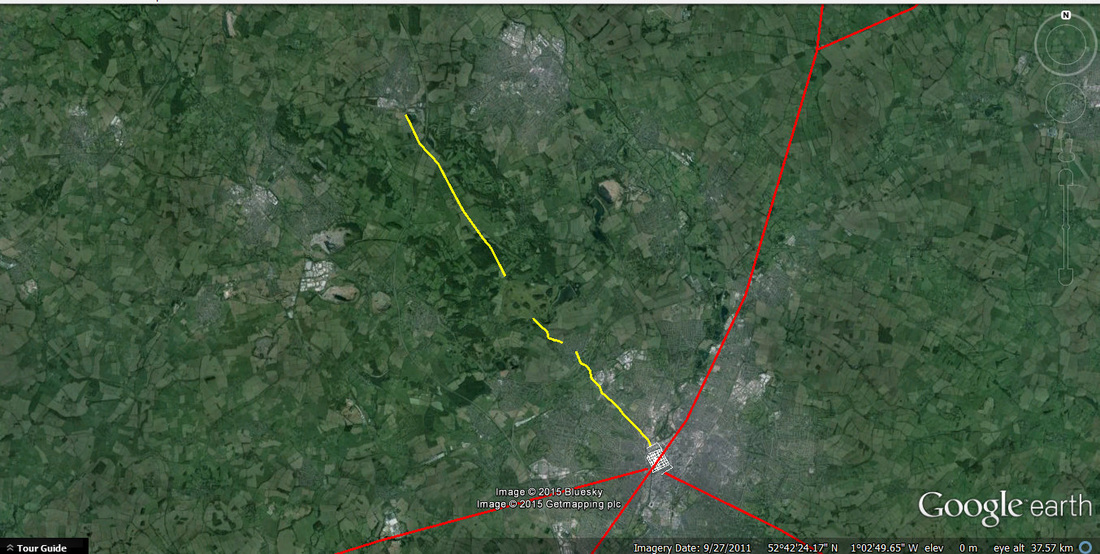
Beyond Bradgate path there is a suspiciously straight road to Shepshed
Here I have plotted existing lines from Leicester ( I have plotted on the Roman street grid , following Wachers’ Towns of Roman Britain) to Shepshed. Hopefully one day we will see this confirmed as a Roman – or even earlier! - route
The nearest car park is in Newtown Linford, up the road from the village where I live, but in fact it is a lot quicker to walk to the ruins from my house ‘ across the fields’.
Thanks to the National Library of Scotland we can see that this foot path on the 19th century OS maps:
http://maps.nls.uk/geo/find/#zoom=13&lat=52.6857&lon=-1.1875&layers=6&point=-1.2084,52.6817
This path is shown here thanks to the magic of google earth:
This path is mentioned in Stephen Lyett’s note (1999 New light on a suspected road between Ratcliffe on Soar and Leicester Trans. Leicestershire Archaeol and Hist. soc, 73 pp 72 – 79) on a possible Roman road/ ancient route. This lines up reasonable well with Anstey lane going towards Leicester and its North gate.
Beyond Bradgate path there is a suspiciously straight road to Shepshed
Here I have plotted existing lines from Leicester ( I have plotted on the Roman street grid , following Wachers’ Towns of Roman Britain) to Shepshed. Hopefully one day we will see this confirmed as a Roman – or even earlier! - route

 RSS Feed
